
Cańón de las Buitreras. Canoying. Serranía de Ronda.
Active Tourism Activities > Canyoning
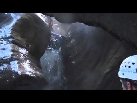
It is doubtless the most important canyon in this area and it clearly stands out in Andalusia. It is a long distance watercourse canyon with narrow stretches and some siphons. It will be a unique experience if the water level is the appropriate but if it rises it could become extremely hazardous. A long wetsuit is required even in summer.
Main Data
- Municipality: Cortes de la Frontera.
- Nearest town: El Colmenar (Estación de Gaucín).
- Coordinates (UTM): X: 287812 y Y: 4048659.
- Estimated time: About 5 hours.
- Number of abseils: 4.
- Longest abseil: 10 metres long.
- Itinerary: Approx. 1,600 metres long with a descent of 80 metres.
- Transport link: It is not completely necessary a transport link although you can drive your car and park it in the electricity power station. You will then walk less than fi ve kilometers along the path GR-141 towards the bridge Puente de los Alemanes.
- Recommended season: Summer and autumn before the rainy season.
- Regulations: It is important to obtain the previous permission from the Andalucian Department of the Environment. It is being discussed to turn it into a public canyon but it is not confi rmed yet. Regardless of what it is written in many other guides, it is completely forbidden, under severe penalty, to walk along the railway.
Cańón de las Buitreras, Cortes de la Frontera. Descenso de Barrancos, Serranía de Ronda
 Cańon de las Buitreras. Descenso de Barranco. Serranía de Ronda
 Cańón de las Buitreras.Barranco. Serranía de Ronda. Cortes de la Frontera
 Cańón de las Buitreras.Barranco. Serranía de Ronda. Cortes de la Frontera
 Garganta de las Buitreras. Cortes de la Frontera
 Garganta de las Buitreras. Cortes de la Frontera
 Garganta de las Buitreras. Cortes de la Frontera
 Garganta de las Buitreras. Cortes de la Frontera
 Garganta de las Buitreras. Cortes de la Frontera
 Garganta de las Buitreras. Cortes de la Frontera
 Garganta de las Buitreras. Cortes de la Frontera
 Garganta de las Buitreras. Cortes de la Frontera
 Griffon Vulture
 Garganta de las Buitreras. Cortes de la Frontera

Cańon de las Buitreras. Descenso de Barranco. Serranía de Ronda
Cańón de las Buitreras.Barranco. Serranía de Ronda. Cortes de la Frontera
Cańón de las Buitreras.Barranco. Serranía de Ronda. Cortes de la Frontera
Garganta de las Buitreras. Cortes de la Frontera
Garganta de las Buitreras. Cortes de la Frontera
Garganta de las Buitreras. Cortes de la Frontera
Garganta de las Buitreras. Cortes de la Frontera
Garganta de las Buitreras. Cortes de la Frontera
Garganta de las Buitreras. Cortes de la Frontera
Garganta de las Buitreras. Cortes de la Frontera
Garganta de las Buitreras. Cortes de la Frontera
Griffon Vulture
Garganta de las Buitreras. Cortes de la Frontera
More information
Discover more about the province of Malaga
- Discover more about the province of Malaga