
Great Axarquía Path (GR 242). Stage 02. Comares - El Borge
Important information
You should be careful while crossing local roads MA-3105 and MA-3106 (the latter one is to be crossed twice). There is also to be cautious when crossing tarmac tracks which lead to different hamlets. The only stream which is to be forded is Paomé, which is hardly ever difficult. Except from three villages along the second stage of the 242 long-distance path, there are no places where you can supply yourself with water, although in the case of emergency, you can always look for it in the surrounding scattered farm houses. The route goes across some farmland and vineyards which must be looked after during your walk.
Access to the start: From the Málaga Avenue, where Puerta de Málaga [the Gate of Málaga] and the Tourist Information Centre are, you should go upwards to the town centre and turn right into the first street. This is where the information board which marks the start of the trail is.
Access to the end: El Borge town road, on the road MA-3109, 115 m (377 ft) away from the Arco de la Pasa [Raisin’s Gate], where the access to El Borge village towards Almáchar is.
Sections in common with official trails
This section does not merge with other official trails.
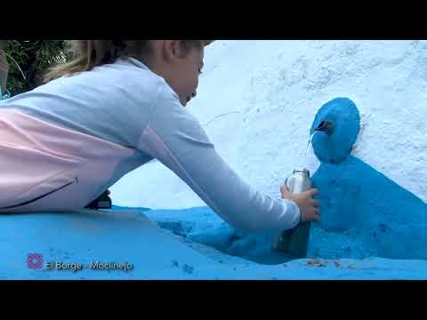
From the start, which is popularly known as Washing Place Path (Camino del Lavadero), the trail matches the local paths of Buena Vista and Fuente Gorda. You will leave behind the hill where Comares lies. Very soon you will get to the crossroads with Hilarico lane and turn right into a street that, before merging with a road MA-3105, splits and one of its parts becomes a path. Above the crossroads with this road, cliffs of Haza Grande lift as two beautiful limestone precipices made by weathering and visited by Eurasian crag martin. Once you have made sure there are no cars, go across the street and look for Alquería lane. At the same crossroads, opposite a bus stop, there is a path which goes to Alquería Stream. There is the Washing Place (Lavadero) Fountain where women from Comares used to come to wash.
There are several villages along the 242 long-distance path, such as Huerta Baja. You will keep walking down, surrounded by a lot of carob trees and a stunning view of Velez Málaga cove and the blue Mediterranean Sea. No doubt, Moorish inhabitants, who found fertile land watered with numerous springs in the area, used to be aware of the protection that these hills, which look southwards, can offer. Today, plenty of those old farmsteads were turned into second homes and the old water reservoirs are used to help with the summer heat.
This second stage goes towards the small villages Gómez and the Gutiérrez, to the bottom of an enclosed valley of the Palomé Stream. However, the dirt track in front of you follows the flat stream curve, and crosses to the opposite shore, having made an arch which avoids walking down and up a steep slope. The ford of this small tributary of the Benamargosa is a quiet place full of life. There is water in it even in summer. There are oleanders and willows on the riverbanks, which give home to insects, amphibians and small birds like Eurasian wrens and Eurasian blackcaps.
Here, the hills, as in other parts of the Mediterranean mountains, limit farming activity in relation to sunny parts of the day and humidity. This also influences the choice of the crops. In this case, one can see the lack of care of some almond and olive groves, abandoned farmsteads as well as increase in vineyards where possible.
Once you have forded the Algamiz Stream, go around Aguilera HIll. You will walk in peace and quiet and witness a change in agriculture and livestock farming. Vineyards are scattered on steep slopes. Next to small farmsteads, you will see raisin farms and a network of winding ditches which get to every corner of the plots. This is an outstanding cultural scenery in the Mediterranean mountains. Apart form the places influenced by human activity, there is Mediterranean plant life in small valleys and more remote places. These are two faces, past and present, of this land.
Tropical kind of trees have also been brought to this area of La Axarquía. The display of trees is very varied and surprising, as there are tropical species which are mixed with Mediterranean ones - there are mangos, avocados, vineyards, almond and olive trees, and some of them are hundred years old.
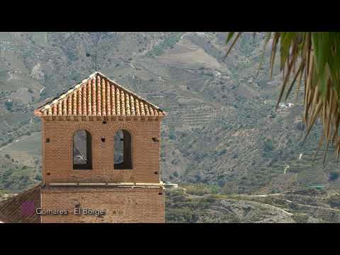
You can also entertain by finding out some geographic landmarks, such as the section of the Great Path in La Axarquíe. Besides Comares, which can be easily spotted on the top of a hillock, Maroma Peak, or the long-distance 242 path, which is constantly followed along this route, there are also other locations that stand out like Benamargosa, Boquete de Zafarraya, mountain pass between La Axarquía de Málaga and Alhama in Granada, or a curious crag called Peńa del Hierro (Iron Crag), where an important archaeological site that comes from the period between the Neolithic and the Bronze Age is. This limestone outcrop is frequently visited by climbers.
Next nearby destination is Cútar. Up to this point you will have walked for 9 km (5.6 miles), and there are 2.3 km (1.4 miles) left to El Borge. We recommend walking along steep narrow streets in this typical white village in La Axarquía, where Moorish heritage can be seen in every part of the old town. You should also visit the parish church of Mudejar style or Aína Alcaharía Fountain.
Continue walking along Málaga Street, up to some stairs which lead to km 0 of the Benamargosa - El Borge (MA-3106) road. The Great Path of La Axarquía is right in front of you, southwards, and can be reached by a steep concrete lane which is surrounded by olive groves and almond trees. There is a drop of 110 m (361 ft) less than a kilometre away. You should then go downwards slowly and enjoy wonderful panoramic views of very varied sceneries. Once you have reached Cútar, there is to stop in order to rest and admire a beautiful landscape. Out of four ways in front of you, you should choose the second one which is a drovers’ road called Vereda de Cútar, one of many ways of public domain which go across different villages and towns in La Axarquía.
A bit after you start walking downwards, close to a water tank, the way turns into a path. El Borge village is at the bottom as well as Almáchar hamlet. Continue walking along the ridge between two small valleys which end in the stream of El Borge, among vineyards, almond trees, olive groves and avocado terraces. Wild plant life is also plentiful and covers the borders of the way and uncultivated ground. There can be seen Genista umbellata, brooms, esparto grass and the fennel, besides small birds such as crested larks and Sardinian warblers. The blue agave from the north of Mexico and the USA is also common. It was brought to Europe by Spanish and Portuguese sailors. In Andalusia, it is called ‘pita’ and has plenty of medicinal properties. Even though it is considered to be an invasive species, it has been part of the Mediterranean landscape for a long time.
The path foes along a way which ends at the MA-3109 (El Borge-Almáchar) road, next to El Borge village. We recommend getting to the town by the nearby Arco de la Pasa (Raisin’s Gate). There is a large window with a beautiful view of the village. A bit further on, you will see the Vendimia [Grape Harvest] Fountain, which recalls the importance of wine production in this place. It is also known for being a place of birth of a scary bandit Bizco. ‘The Bandit’s Gallery’ is also worth visiting.
 Restos de la fortaleza de Comares
 Comares
 Ruta El Lavadero. Comares
 Ruta Fuente Gorda. Comares
 Paneles Inicio GR 242 Etapa 2 Comares El Borge reduc
 Paneles Inicio GR 242 Etapa 2 Comares El Borge 2 reduc
 Paneles Inicio GR 242 Etapa 2 Comares El Borge (sentido inverso) reduc
 GR 242.2 - COMARES - EL BORGE 096
 GR 242.2 - COMARES - EL BORGE 095
 GR 242.2 - COMARES - EL BORGE 094
 GR 242.2 - COMARES - EL BORGE 093
 GR 242.2 - COMARES - EL BORGE 088
 GR 242.2 - COMARES - EL BORGE 090
 GR 242.2 - COMARES - EL BORGE 091
 GR 242.2 - COMARES - EL BORGE 089
 GR 242.2 - COMARES - EL BORGE 085
 GR 242.2 - COMARES - EL BORGE 084
 GR 242.2 - COMARES - EL BORGE 080
 GR 242.2 - COMARES - EL BORGE 083
 GR 242.2 - COMARES - EL BORGE 079
 GR 242.2 - COMARES - EL BORGE 077
 GR 242.2 - COMARES - EL BORGE 076
 GR 242.2 - COMARES - EL BORGE 075
 GR 242.2 - COMARES - EL BORGE 074
 GR 242.2 - COMARES - EL BORGE 072
 GR 242.2 - COMARES - EL BORGE 070
 GR 242.2 - COMARES - EL BORGE 067
 GR 242.2 - COMARES - EL BORGE 065
 GR 242.2 - COMARES - EL BORGE 064
 GR 242.2 - COMARES - EL BORGE 063
 GR 242.2 - COMARES - EL BORGE 061
 GR 242.2 - COMARES - EL BORGE 060
 GR 242.2 - COMARES - EL BORGE 058
 GR 242.2 - COMARES - EL BORGE 056
 GR 242.2 - COMARES - EL BORGE 057
 GR 242.2 - COMARES - EL BORGE 055
 GR 242.2 - COMARES - EL BORGE 054


More information
Discover more about the province of Malaga
- Discover more about the province of Malaga