
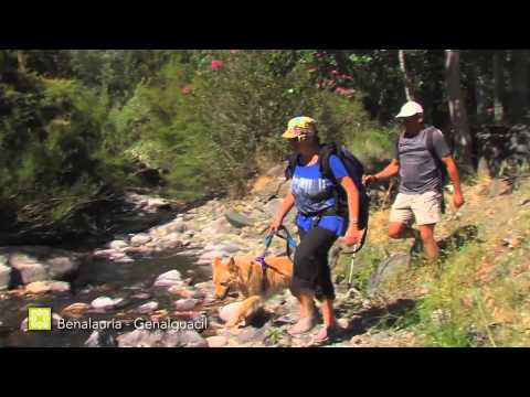
Great Malaga Path (GR 249). Stage 27. Benalauría - Genalguacil
1. Initiation Stage:
Access Starting point: The only possibility is to use the MA 8306, which leaves from the A-369 between Ronda and Gaucín.
Starting point: Plaza del General Vińas, in Benalauría.
Enjoy the walk safely: The distance between the starting and finish point is very attainable but walking along the road in between is complicated. It is advisable to plan your return or your overnight stay well.
The two intersections of Algatocín to Jubrique road and especially the little stretch you have to walk along this road to cross the river Genal must be approached with caution. There is no usable hard shoulder and there are two diffi cult bends before and after the bridge. (km 6.3).
Although the path which runs along the river Genal has been designed with walking in mind, minimising any risks, the riverbed is quite formidable and the water level can rise substantially, to the point of becoming dangerous. Common sense must be used in case of storms or long periods of rain even if it may result in your having to cancel your walking.
2. Completion of Stage:
Access to finish point: From the A-369, the MA-8305 takes you to the intersection of the MA-8304 which accesses Genalguacil. Starting point is before the village. It is also possible to come from Estepona, either directly along the MA-8302 or through Jubrique via the MA-8301.
Finish point: Pistas Polideportivas Municipales de Genalguacil, (sports centre) close to Venta Las Cruces.
3. Alternatives:
Possible "escape routes": It is feasible to leave at Venta San Juan, on the MA-8305 at km 7 marker, close to Venta San Juan.
No return point: For the fi rst section this would be before Puente de San Juan; and the intersection with the path to Molino Almenta is your chosen point of no return. As for the second part of the stage, once you have passed Arroyo Hondo it is best to continue ahead.
Connections to other footpaths and trails:
PR-A 236, Benadalid – Benalauría, links up at start, PR-A 238, Benalauría-Algatocín & PR-A 291 Jubrique-Benalauría, partial overlap, GR 141, Great Path of the Serranía de Ronda, overlap up to La Escribana, PR-A 240, Benarrabá - Genalguacil, overlap from La Escribana on.
Hazards:
• Road traffic circulating before San Juan Bridge
The ‘Caminos’ of Jubrique & El Arabí (Up to km 6)
From the Plaza del General Vi as in Benalaur a, head east along the streets Iglesia and Cruz, until you reach the fountain of La Cruz, on a kind of balcony overlooking the Algatoc n Way below. After a sharp bend in the road, once in the outskirts and surrounded by Almond trees, Olive trees and Prickly pears, you reach El Chorruelo fountain. You then turn south-east along a forest track, through ever more abundant Chestnut trees.
At kilometre 1.2, you come to the Bailadero area, a levelled off area for traditional festivals with outdoor gym equipment. From here, the PR A-238 breaks off to the right in the direction of Algatoc n, which can be seen to the south-west. The PR A-291 then continues on from there to Jubrique, off to the left. Away to the east are the whitewashed houses of Alpandeire and Faraj n, settled between the mountains and forested uplands. The route then makes a steep descent through a sun-blushed Cork oak forest with some Holm and Gall oaks. Pine trees become more plentiful once you leave the track (km 2.3), to take a very steep track off to the right.
At the 3-kilometre mark, a not so steep footpath goes off to the left to the Almenta mill, while the Great Path continues downhill until it reaches a country track, at a long bend. El Arab is a junction of tracks where you take the path to the north-west. This makes another sharp turn when it crosses the Benajamuz stream.
The route continues through the considerable Cork oaks of the public uplands of El Coto and Vega del R o, until it reaches the MA-8305 road. This offers some excellent views to the north-east, over the Picado waterhole and the long straight stretch of the Genal past the Enmedio mill. The footpath now crosses the road twice, descends a steep-sided mound and reaches an old sawmill. Use the tarmac when crossing the bridge of San Juan over the Genal (km 5.7).
The walkways of the River Genal (Up to km 9.5)
Take the campsite track to go round the back of the San Juan Inn, before turning off onto a path that goes past the pretty mill of El lamo. The route then follows the Genal, with Willows and Poplars on display. The next river you cross is the Monardilla, with plenty of European hackberry trees, Tamarisks and Oleanders. It climbs a little alongside the stream until it reaches the promenade-like El Ventorrillo, where it turns towards a deep oxbow lake. Few places on the Great Path have such a variety of trees and shrubs as here.
The uneven footpath then goes along the riverside, surrounded by dense woodland. After a narrow and winding footpath, you reach the track of the Juan Ruiz farm. There are some steps for a now non-existent bridge before reaching the Genal’s tightest bend where the first walkways and steps are located (km 7.2), opposite the fertile plains of La Estacá.
After a water intake with plenty of Bear’s breeches, you cross the Hondo stream, and come onto the extensive plains of Los Cuarterones, with only a few properties. The route follows the old irrigation channel, which is equipped with safety cables. Go over the Perejilas stream and up a steep slope to reach the much more open landscape of the Los Tejarejos plains. At the next walkway you come to, you climb some steps before going back down to the level of a disused irrigation ditch. This is on a fairly open area on the flood plains, called Los Duros with large Poplar trees, once through a gateway. There are large reed beds that lead on to the last walkway and steps, called Los Limones (km 9.2). This leads on to a ruined weir, before passing between a Poplar plantation, the river and some high slate cliffs. After going through another small gate, there is an optional diversion down a small track to the Escribana water hole (around km 9.5), an important meeting point of paths and tracks and recreational area.
The Shaded Route (To the end of the stage)
Instead of this, the Great Path takes on a stunning climb up the Cordel de la Umbr a (the Shaded Line) to the River Genal. The footpath was created by cutting into the slate, reaching above head height, particularly at the steepest part when it crosses the track to Los Duros.
Heading east and under a mixed forest of Cork oak, Gall oak and Pine trees, you pass a track that climbs to the left, to the Genalguacil road. The path continues to climb steeply until it reaches a small building and begins to flatten out little by little. The landscape opens out and there are numerous lookout spots over the Genal valley.
From a flat area with large Cork oaks, the sharp peaks of the Natural Park of the Sierra Bermeja come into view, while Genalguacil gets ever closer. To the south you can see the Sierra Crestellina and on a clear day, the Strait of Gibraltar. Benarrab is on the other side of the valley, to the west.
The path runs between small fields and one last climb takes you past the Camino de los Limones on your right, over sections of traditional path and the access lanes to the properties. After the sports facilities of Genalguacil, you reach Las Cruces, where this stage comes to an end.
 GR 249. Stage 27. Benalauría - Genalguacil. The walkway of the Vega de la Estacá over the clean waters
 GR 249. Stage 27. Benalauría - Genalguacil. The old sidewalk among newly uncorked cork oaks
 GR 249. Stage 27. Benalauría - Genalguacil. The hedgehogs of the chestnuts starting to open
 GR 249. Stage 27. Benalauría - Genalguacil. The town of Genalguacil, final destination of the Path
 GR 249. Stage 27. Benalauría - Genalguacil. Benalauria
 GR 249. Stage 27. Benalauría - Genalguacil. Chestnut
 GR 249. Stage 27. Benalauría - Genalguacil. Landscape of the Genal
 GR 249. Stage 27. Benalauría - Genalguacil. Modardilla Channel
 GR 249. Stage 27. Benalauría - Genalguacil. Brimstone Butterfly (Gonepteryx rhamni)
 GR 249. Stage 27. Benalauría - Genalguacil. Genal riverbank
 GR 249. Stage 27. Benalauría - Genalguacil. Butterfly Marsh Fritillary (Euphydryas aurinia) on oleander flower
 GR 249. Stage 27. Benalauría - Genalguacil. Rio Genal by the Charca de la Escribana
 GR 249. Stage 27. Benalauría - Genalguacil. Genalguacil
 GR 249. Stage 27. Benalauría - Genalguacil. El Genal is an excellent area for wild mushroom picking, such as this boletus
 GR 249. Stage 27. Benalauría - Genalguacil. Algatocín seen from the starting point of Stage 27
 GR 249. Stage 27. Benalauría - Genalguacil. Mix of colours in the thickets of riparian vegetation of the Genal
 GR 249. Stage 27. Benalauría - Genalguacil. Riding the mule up to the village after work 289
 GR 249. Stage 27. Benalauría - Genalguacil. Mixed pine and quercus species in woods of the Genal
 GR 249. Stage 27. Benalauría - Genalguacil. Holm oak acorns ripening


More information
Discover more about the province of Malaga
- Discover more about the province of Malaga