
Great Malaga Path (GR 249). Stage 14. Villanueva de Tapia - Villanueva de Algaidas
1. Initiation Stage:
Access Starting point: From the A-92 take the A-333 Archidona Alcaudete. From Malaga, the A-333 direction Granada and then A-359.
Starting point: Villanueva de Tapia, at the roundabout near Constitution Avenue, in the south of the village, passing below the road A-333.
Enjoy the walk safely: The stretch that may worry you a bit more is the long way from the Sierra of el Pedroso to the Arroyo of Bebedero. There is a real maze of tracks, a few asphalted and others not, and the advice is not leave the waymarked way. There is no drinking water throughout the tour.
2. Completion of Stage:
Access to finish point: There are two connections from the A-92 Seville-Granada, A-7201 from Archidona and the A-7221 from Antequera.
Finish point: Villanueva de Algaidas via the Almeria Street, ending the stage at the junction of the MA-6416 with MA-7203 to Cuevas Bajas.
3. Alternatives:
Possible "escape routes": From the road that you cross at the km 6, before descending to the Arroyo de Bebedero you can continue and reach Archidona train station.
No return point: When you reach the road MA 5100 it is not worth going back, continue down and reach the next village on the GR.
Connections to other footpaths and trails:
GR-7 E-4, Almost complete overlap, except the final portion, All route GR 249.3, Overlap until km 2.7, and GR 245, Mozarabic Way of the Camino de Santiago – links up at the end of the stage.
Hazards:
• Road traffic circulating along the farm tracks
• Crossing and the crossroads of the A-5100 road.
The Sierra del Pedroso and the Dehesa pastures of Holm Oak (Up to km 2.7)
The steep climb from Villanueva de Tapia, up the livestock track of El Entredicho is through mature Olive groves with occasional gullies going off on each side. These are caused by erosion from sporadic and intense rainfall run-off. Keeping the Sierra on your left as you approach it, you pass a group of houses in ruins known as Los Curros (km 1.4). Shortly after, you pass the ruins of Casilla de la Sierra, an old farmhouse in an excellent strategic position, with views of La Nava and the shady slopes of the Sierra del Pedroso. A young Holm oak forest with numerous Kermes oaks covers the sharp lapies (limestone pavement) with a thick layer, making it difficult for hunters and mountaineers, the area’s most frequent visitors to reach the summit.
Interestingly enough, the Holm oaks that have made it down from the Sierra and close to the road tend to be smaller, while those in the middle of the Olive groves, on the right side of the road are larger. These are remnants of the area’s more glorious past. In spite of the human influence on the environment, a certain balance has been maintained in order to prevent soil erosion. So, natural woodland is left to occupy ravine bottoms, field boundaries, steep scree slopes, rocky outcrops and inclines.
The country house of El Cortijo de las Morenas is found at the iconic northern corner of the Sierra, just at the start of the El Infierno ravine (km 2.7). To the right of the path, the rugged river channel carries water north and is filled with dense vegetation. It later flows into the Bebedero stream before entering the village of the Stage’s destination. The farmhouse here is a fine example of a traditional construction, with an interior courtyard and cobblestones at the front, to fend off the abundant mud in the fields. You later pass a modest orchard with a few fruit trees: Quince, Walnut, Apricot, Fig, Pear and Persimmon trees. Alternative Route 3 also splits off here.
Farmhouses surrounded by Olive groves (Up to km 6.6)
A short way past the farmhouse, there is a ninety-degree turn to the south. From here onwards, the vegetation begins to change. Once you enter the municipality of Villanueva de Algaidas, Olives become the sole crop and only occupy hills of a certain size. This path has been used for centuries as access to the mountains and properties, the reason for it being lined by numerous houses and farmhouses. Next to the track, the country houses of Los Cascabeles and Los Isabelicos are close together. A little further on, next to the crossroads to Villarto, we find the Casa Blanca and the country houses of Aranda, Moreno and La Casilla. This marks the highest point of the route, at 900 metres above sea level.
The Arroyo del Bebedero stream (To the end of the stage)
Continue on down until you meet the MA-5100 road, which you walk along for some 500 metres, with El Endrinal (Blackthorn bushes) below you, and then take a country track to the right, heading west.
At the bottom and close to some warehouses and farmhouses, you cross the Arroyo del Bebedero stream. You then continue parallel to the stream, but halfway up the valley side before dropping down to the water’s edge (km 8.8). Rich woodland with many Holm oaks covers this area. You reach a larger track, whose bridge crosses the stream twice and then you begin the descent once again, on the right bank. Dense natural vegetation of Holm oak and Gall oak trees surrounds the pathway, which becomes diverse and varied woodland closer to the stream.
This small watercourse emerges from the western flank of the Sierra del Pedroso hills and follows the Great Path’s route and soon narrows considerably. There is then a pool from a small spring, followed by the water mill, El Molino Pozo. In front of this are other buildings, also in ruins. On the opposite side of the valley, you can see a wide band of Gall and Holm oaks on the steep clay escarpments, stretching down through Olive groves to the stream’s edge.
The riverbed here is compacted due to the high load of carbonate minerals, which led to the existence of a crayfish population in the past. The limestone strata underlying the clays can also be seen.
The most sheltered area is known as Rondán and Malabrigo. As the valley widens out, new houses appear along the way, Los Mateos, Los Peláez Castle and Ventorro el Prieto (an old inn) (km 11.8). These stray from the stream until you reach the Albaicín. Taking the left-hand fork and making a sharp 90-degree turn, you keep the property to the south and head downhill in a westerly direction, through Olive trees.
The route crosses the Bebedero stream again close to a group of buildings, where it climbs a little and comes to the Stage’s finish at the Peńa de Villanueva de Algaidas hill.
 GR 249. Stage 14. Villanueva de Tapia - Villanueva de Algaidas. La Casilla de la Sierra on the forest island of the Pedroso mountain range
 GR 249. Stage 14. Villanueva de Tapia - Villanueva de Algaidas. Vegetable mosaic of olive grove and holm oak in the rocky area
 GR 249. Stage 14. Villanueva de Tapia - Villanueva de Algaidas. The Bebedero stream with its interesting riverside forest
 GR 249. Stage 14. Villanueva de Tapia - Villanueva de Algaidas.
 GR 249. Stage 14. Villanueva de Tapia - Villanueva de Algaidas. Villanueva de Tapias and limestone arch in the background
 GR 249. Stage 14. Villanueva de Tapia - Villanueva de Algaidas. Initial section from Villanueva de Tapia
 GR 249. Stage 14. Villanueva de Tapia - Villanueva de Algaidas. Sierra del Pedroso and olive grove
 GR 249. Stage 14. Villanueva de Tapia - Villanueva de Algaidas. Interpretive panel at the foot of the Sierra del Pedroso
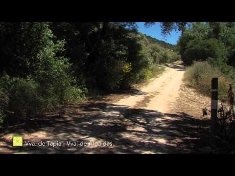
 GR 249. Stage 14. Villanueva de Tapia - Villanueva de Algaidas. Crossing point with the MA-5100 road
 GR 249. Stage 14. Villanueva de Tapia - Villanueva de Algaidas. The clay slopes covered in Olive trees surround a little riparian forest in Barranco del Infierno
 GR 249. Stage 14. Villanueva de Tapia - Villanueva de Algaidas. The Arroyo Bebedero maintains enough pools and an excellent representation of riparian groves
 GR 249. Stage 14. Villanueva de Tapia - Villanueva de Algaidas. The rows of olive trees respect the ancient specimens of oak, some of them large and in excellent health
 GR 249. Stage 14. Villanueva de Tapia - Villanueva de Algaidas. Trail section with Mediterranean vegetation
 GR 249. Stage 14. Villanueva de Tapia - Villanueva de Algaidas. In the distance, the mountains of the Central Limestone Arch framing the white village of Villanueva de Tapia
 GR 249. Stage 14. Villanueva de Tapia - Villanueva de Algaidas
 GR 249. Stage 14. Villanueva de Tapia - Villanueva de Algaidas. The clay slopes covered in Olive trees surround a little riparian copse in Barranco del Infierno
 GR 249. Etapa 14. Villanueva de Tapia - Villanueva de Algaidas. En los pastizales de la Sierra del Pedroso se crían los llamativos Biarum, de desagradable olor e intenso color
 GR 249. Stage 14. Villanueva de Tapia - Villanueva de Algaidas. Rows of Holm oaks and Gall Oaks stand out amongst the olives in the streams and dry stone walls
 GR 249. Stage 14. Villanueva de Tapia - Villanueva de Algaidas. The Arroyo Bebedero maintains enough pools and an excellent representation of riparian groves
 GR 249 Etapa 14 Encinas con matorral mediterráneo
 GR 249 Etapa 14 Arroyo del Bebedero
 GR 249 Etapa 14 Aguilucho cenizo
 GR 249 Etapa 14 Cangrejo de río
 GR 249 Etapa 14 Arańa cangrejo
 GR 249 Etapa 14 Erizo común


More information
Discover more about the province of Malaga
- Discover more about the province of Malaga