Heading along Calle de la Glorieta to the north east of the village, tucked away in the foothills of the Sierra Blanquilla or Sierra de Ba±os, we find the Plaza de Toros (Bullring). In the second...
This web page uses its own cookies and the third-party cookies to collect the information which help us make the service as good as possible. By no means is our intention to use it for gathering personal data.

This region, situated in the north of the province, borders the countryside of Seville in the North; the valley of Guadalhorce in the south; the mountain ranges of Ronda and Cardiz in the east; and the floodplain of Antequera in the south. It represents the beginning of the so-called Surco Intrabetico, an enormous natural corridor, which links Andalusia with Spanish Levante (east coast of the peninsula).
The most important terrains are located in the south, shaping an area of great environmental interest. From east to west, Valle de AbdalajŅs Mountains, Pizarra Mountains, Aguas Mountains, Ba±os Mountains, AlcaparaŅn Mountains and OrtegŅcar Mountains.
This mountain range has determined both the climate conditions and the communication between the region and the south part of the province, which takes advantage of natural mountain passes, making it very difficult to find alternative access ways.
This region has a continental climate, with harsh winters and very hot summers. The annual average temperature is 15 to 16 degrees and the average rainfall is 600 to 700 mm. Guadalhorce River brings the main part of the water that comes into the region through its tributary rivers, Guadalteba and Tur¾n.
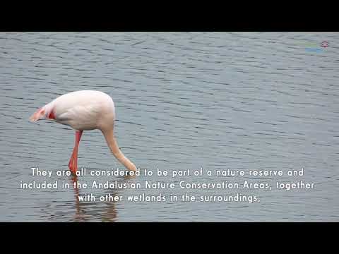
Due to the diversity of its landscape and its environmental conditions, visitors can observe spectacular natural spots, such as ecosystem of the lagoons of Campillos, the park of Ardales and the reservoirs of Guadalhorce-Guadalteba, which are doubtlessly one of the most relevant natural spots. Here is as well the Caminito del Rey in the canyon Los Gaitanes, which is perhaps the natural resource of major interest of the province of Malaga.
All of this together with the beauty of its villages, gastronomy and craftsmanship, shape the perfect surrounding for those who search cultural, ecological and active tourism.
AGRICULTURAL PRODUCTS
Products derived from stock farming, milk products, fruit and vegetables.
CRAFTWORK
Stonework, textile, wood and forge works.
FORESTRY
Silviculture.
INDUSTRY
Wine-producing, technologies, auxiliaries for the construction sector and alternative energies.
TOURISM
Cultural heritage, congresses and incentives, nature.
Ā
More English information of Guadalteba on the website of the Costa del Sol Tourist Board.
Heading along Calle de la Glorieta to the north east of the village, tucked away in the foothills of the Sierra Blanquilla or Sierra de Ba±os, we find the Plaza de Toros (Bullring). In the second...

The three Guadalteba Guadalhorce reservoirs are nestled in one of the beautiful natural environments of Ardales. In this Natural Park there are three large reservoirs: Conde de Guadalhorce,...

The former convent of San Sebastian is located in one corner of the Plaza of Ardales. This building housed a religious community of great influence during the seventeenth and eighteenth century. In...

The Lakes of Campillos (Up to km 8.5) The route advances along the long street named Calle Doctor ėscar Fernßndez in a south-easterly direction, between some relatively new...

Campillos boasts one of the most beautiful inland locations to be found anywhere in the province. The area is home to a total of eight lakes of immense geological importance which belong to the...

This Center shows the visitor the natural wealth of the municipality and aims to create awareness of the importance of natural resources, valuing each of the elements that make up its environment....

This festival has been declared to be of Tourist Interest by the Provincial Council of Mßlaga. Please check with the local Town Hall or Municipal Tourism Office for the festival date before...

This festival has been declared to be of Tourist Interest by the Provincial Council of Mßlaga. Please check with the local Town Hall or Municipal Tourism Office for the festival date before...

This festival has been declared to be of Tourist Interest by the Provincial Council of Mßlaga. Please check with the local Town Hall or Municipal Tourism Office for the festival date before...

This exclusive resort, which remains in operation throughout the year, has 14 separate rooms, all equipped with the best facilities, located in three buildings: Zaira apartment with capacity for 2...

PECULIARITY Restaurant attached to the hotel boutique Posada del Conde. With its brick stone walls and wooden roofs and ceilings, this building is a typical Andalusian construction. Although the...

These apartments, located in the historic center of Ardales, are new (September 2006) and open all year around. There are a total of 17 apartments with different capacities: for two, three, four,...

This fifth stage starts in the area of Guadalteba and goes deep into the Sierra de las Nieves . It begins in Ardales, it is 266 km long, and crosses nine municipalities. A big part of the...

Through its website, the municipality offers information on the most relevant activities that take place regularly. If in doubt, contact the Town Hall..